
Pilot Insights | Can AI help improve reforestation? Lessons from Nicaragua
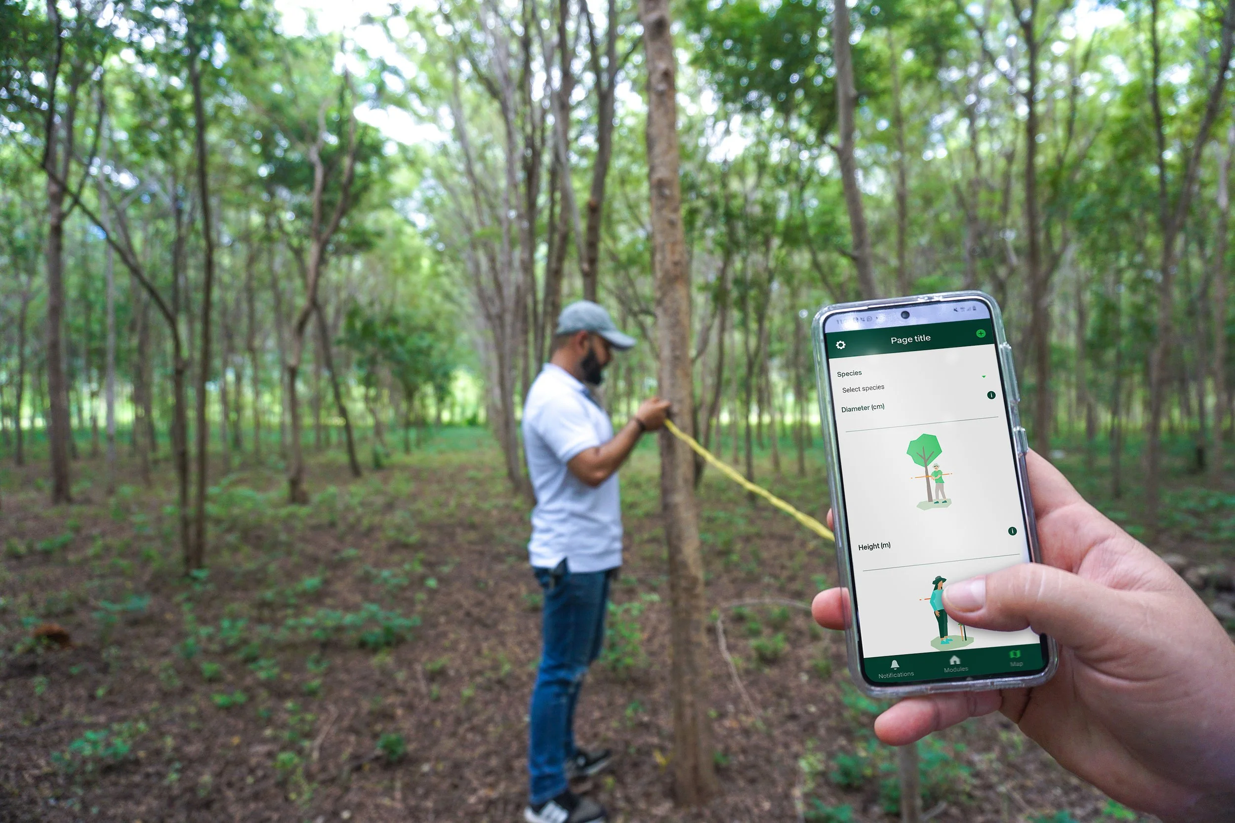
Image courtesy of Taking Root
Reforestation is not simple. It is not just about planting trees and letting them grow. Successfully restoring degraded land requires consistent, time-sensitive care, including weeding, pruning, thinning, and pest management, carried out at the right moment, season after season. In a place like Nicaragua, it also means enrolling thousands of smallholder farmers, each managing their own parcel of land, at a different stage of their forests’ development, and with a different level of experience and need for support.
Taking Root has been doing this for years. Through their CommuniTree Carbon Program, they have built one of the most rigorous agroforestry programs in the region, working with local partner BOSNICA to support close to 5,000 farming families across Nicaragua. Their model is proven; farmers restore degraded land, earn income through timber, forest products and carbon credits, and contribute to ecosystem recovery in their communities.
But as the program scaled, supporting all farmers became harder. A field technician can only visit so many parcels in a week. Formal monitoring happens at years 1, 3, 5 and 10 after planting, leaving long gaps in visibility between cycles. And while the program’s guidance was standardized and carefully designed, not every farmer needed the same support at the same time (and not every technician offered the same level of support). Some parcels were thriving. Others were at risk of falling behind. Without a smarter way to identify which was which, the program had no systematic way to match technician time to farmer need.
In this context, we wanted to test whether AI could help field technicians direct their attention to the farmers and parcels that need it the most. If yes, would this result in better outcomes for farmers, healthier parcels, and a more efficient program?
Why We Backed this Pilot
This partnership emerged from Prosper Global Ventures’ AI for Climate Resilience call for proposals, through which we received over 300 applications exploring how AI could build climate resilience in emerging economies. Nearly half centered on agriculture, reflecting both the scale of the challenge and the range of ways AI is being applied to address it.
As we reviewed those proposals, we began to see three distinct levels at which AI could make a difference in agricultural systems. The first is improving the efficiency of existing support structures, helping people and organizations that already serve farmers do so more effectively. The second is expanding reach, putting AI-powered advice directly in the hands of more farmers than any extension network could realistically visit. The third is deepening the understanding of the land itself, using AI to analyze soil and plant conditions and prescribe targeted interventions at a farm (or even plant) level.
Taking Root sits at the first level. They already had a proven model, deep operational experience, and a network of dedicated smallholder farming families restoring land. What we wanted to test was whether AI could help them use those resources more efficiently, specifically, whether it could help technicians identify which parcels needed attention most urgently, and when, so that time in the field could be allocated where it would have the greatest impact.
We structured the pilot around three hypotheses: that AI-driven recommendations would improve the success rate of agroforestry systems; that this would enable more farmers to build climate and economic resilience; and that it would reduce the cost of supporting those farmers over time. These were intentionally long-horizon questions. A six-month pilot in three regions could not answer them definitively, but it could tell us whether the foundations were sound and where to focus next.
Building the Right Tool Starts with the Right Data
Before any AI tool could be built, Taking Root’s product and engineering teams had to work out what data should power it. The initial plan was to use forest inventory monitoring data to classify parcels as on or off track. But the team quickly recognized that this data, while valuable for confirming long-term outcomes, is a lagging indicator - collected only periodically and years apart - and so could not trigger timely interventions.
Drawing on years of program data and survival analysis, the team identified additional leading indicators that could signal parcel performance in real time: species type, number of weeding events, climate region, and timeliness of silvicultural activities. Technicians were capturing this data through regular field visits, and every farmer joining CommuniTree receives a silviculture activity plan outlining prescribed management practices and schedules. Together, these datasets formed the foundation of a parcel stages model that could assess each parcel's performance and flag those needing attention between formal monitoring cycles. The parcel stages model assigns each farm parcel a status based on how it is performing against key silvicultural milestones, such as the timeliness and completeness of activities like planting, weeding, and pruning. Drawing on field data collected by technicians, early success indicators from high-performing parcels, and prescribed management plans, the model gives each parcel a score that helps field teams quickly identify which farms are on track and which need additional support.
“In forest restoration, what happens in the first 12 months shapes outcomes for generations. Years of field data and operational experience have shown us exactly what drives success: planting within optimal windows, maintaining forests through establishment, and intervening precisely when it makes a difference. The challenge is not just knowing what works, it’s guiding thousands of farmers to carry out those practices consistently, season after season.” - Laura Morillas, Reforestation partnerships (Nicaragua) Director, Taking Root
These insights became the foundation of the AI framework. Deploying AI effectively in a complex field program means thinking carefully about what question you are trying to answer, and whether the data you plan to use can actually answer it in time to make a difference.
What the Pilot Showed
In September 2025, the AI framework was deployed across three pilot regions, Somoto, Jinotope, and San Juan de Rio Coco. Ten field technicians would be using AI-generated parcel scores to inform their weekly planning. Each parcel was automatically classified as “on track” or “off track” and assigned a performance score, with those scoring below 80 flagged for follow-up.
The results were instructive. Of the 67 parcels included in the pilot, 41 were visited specifically because of the AI scores, and 3 were added to technicians’ weekly plans because the platform flagged them as needing attention. These are parcels that may otherwise have been overlooked. Technicians verified field conditions for these 44 parcels over the two-month period, providing the ground-truth data needed to validate and refine the model.
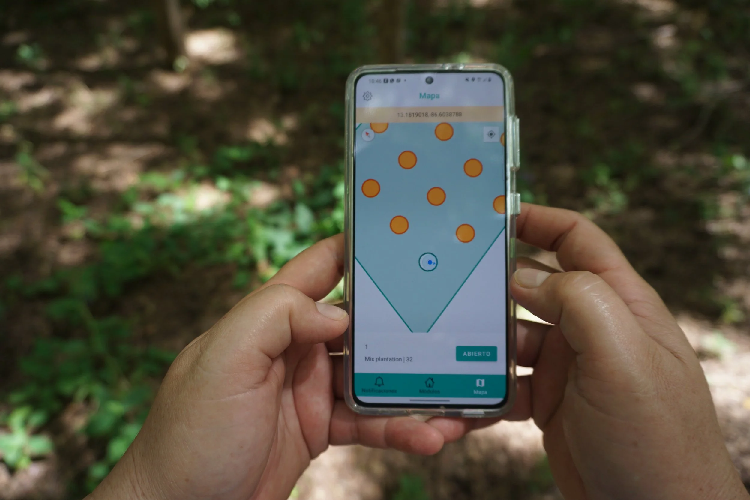
Image courtesy of Taking Root
There were early technical challenges. Initially, parcel scores were only generated when new activity data was uploaded, creating visibility gaps. A scoring bug caused some parcels to display inaccurate, often, lower scores. Both issues were resolved through system refinements. Once corrected, technicians provided positive feedback, and the tool demonstrated its core value: providing real-time visibility into parcel health without adding extra fieldwork.
The pilot also surfaced an important insight about how AI tools get used in the field. During the pilot, the AI tool functioned as a pull mechanism. Technicians accessed data when they chose to consult it during weekly planning. Sustaining this engagement proved difficult alongside competing field demands. The Taking Root team thinks that greater operational value will come from evolving the system into a push tool, one that automatically surfaces priority actions for technicians each week. This transition is now central to Taking Root’s next phase of development.
An interesting finding came from outside the parcel scoring work entirely. In exploring other applications of AI within Taking Root’s operations, the team trained a model to review and validate land tenure documents. This was a manual quality assurance process that is a prerequisite for farmer participation in CommuniTree. The model achieved 98.5% accuracy, and automating this process could save an estimated 400 to 600 hours of staff review time in a single season. It is a reminder that when AI is introduced into a complex operational environment, its most immediate value sometimes appears in places you were not specifically looking at.
What This Means for Impact – and What We Don’t Know Yet
The timeline for growing trees is long. The honest answer is that we cannot yet draw strong conclusions about how the AI tool has changed outcomes for farmers. The metrics that matter most – tree survival rates, carbon sequestration, farmer incomes – will only be visible over years, not months.
What we can say is that the program continues to perform strongly. Today, 4,954 families are collectively restoring 18,436 hectares of degraded land across Nicaragua. In 2025, the program issued 321,340 certified carbon credits, representing 1.4 million trees established across nearly 1,200 hectares, with 60% of carbon revenue flowing directly to smallholder farmers through the Community Fund. Cumulative payments from the fund have now exceeded $20.3 million, with 17,354 individual payments made to farmers in 2025 alone.
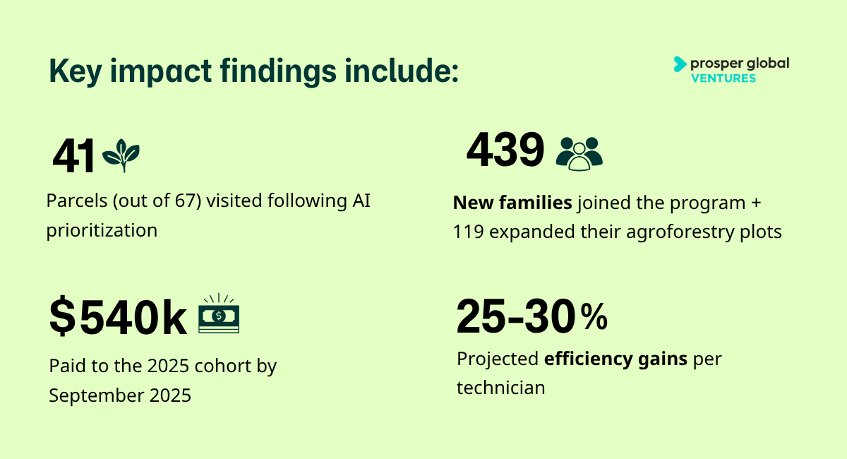
On the efficiency question, the pilot has generated a forward-looking estimate. Internal projections suggest that AI-supported prioritization could enable each technician to manage an estimated 25-30% more land at the same workload, reducing the cost of support from approximately $285 per hectare per year today to $215-240. This estimate will be empirically validated over time by tracking changes in hectares managed per technician and cost per hectare. In addition, the introduction of this AI tool is expected to help scale operations. Taking Root is planning to continue growing steadily in Nicaragua, with 1,400 new hectares planned over the next three years and they just launched a new project in Chile, beginning with 150 hectares with a pathway to reach 20,000. Taking Root technology is designed to scale across geographies and the integration of AI is an important part of how they are growing the program’s reach and impact.
What the Taking Root pilot demonstrates, perhaps most clearly, is that the value of a rigorous pilot is not always the impact you measure. Sometimes it is the clarity you gain – about what data matters, about how tools get used in the field, and about where the real opportunity lies. Taking Root now has a stronger foundation for the next phase of this work.
